You are here
Cycling from Forte Marghera to Forte Bazzera, with views of the lagoon
CYCLING FROM FORTE MARGHERA TO FORTE BAZZERA, WITH VIEWS OF THE LAGOON
This cycle/pedestrian itinerary allows you to discover the area of contact between the mainland and the lagoon, also known as the gronda lagunare (lagoon gutter), which extends from the Parco di San Giuliano northwards in the area of the airport.
The gronda lagunare is a linear collection system for the network of freshwater canals coming from the mainland, built from the sixteenth century onwards to delimit and protect the lagoon ecosystem.
Along the itinerary, you will be able to see various water regulation works and admire the clear difference between the two landscapes: land and lagoon.
The itinerary starts and ends at Forte Marghera, giving you an opportunity to visit this important nineteenth-century fortress that defended Venice from land attacks. However, you can customise the itinerary by starting and finishing wherever you like, according to your requirements.
Back in 2017, the City of Venice launched the #EnjoyRespectVenice awareness campaign to promote sustainable tourism. Please ensure that you always behave responsibly and respectfully towards the city, taking particular note of the following:
- Only purchase goods from authorised retailers
- Use licensed tour guides.
- Duration: 2,5-3 hours
- Distance: 25 km (variable distance if you include the detours to Parco San Giuliano and Bosco di Campalto)
- Mode: by bike along cycle paths
- Suggested period: all year round
- Suitable for children: yes
- Disabled acces: No
- Departure: Forte Marghera - Mestre
- Arrival: Forte Marghera - Mestre
- Public transport to reach the starting point and/or the bike rental stations
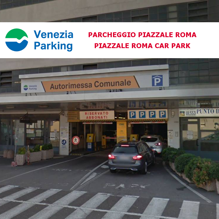
- By car: ample parking at Forte Marghera and Parco San Giuliano
-
Public transport:
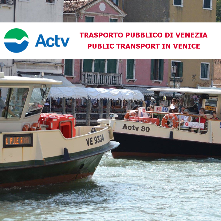
from Venice we recommend taking the tram or buses 43, 19, 5, 24H
from the centre of Mestre, we recommend buses 9 and 15 or the tram.
More information on public transport can be found on the website http://actv.avmspa.it/it
Itinerary details
- Stage 1: Forte Marghera - Bay of Forte Marghera
- Stage 2: Baiy of Forte Marghera - Parco San Giuliano
- Stage 3: Parco San Giuliano – Punta San Giuliano
- Stage 4: Punta San Giuliano - Passo Campalto
- Stage 5: Passo Campalto - Campalto salt marshes
- Stage 6: Campalto salt marshes - Forte Bazzera
- Stage 7: Forte Bazzera - Punta Bazzera
- Arrival: Punta Bazzera - Forte Marghera
-
Sources
Punta Bazzera, the closest point to Marco Polo airport
Stage 1: Forte Marghera - Bay of Forte Marghera
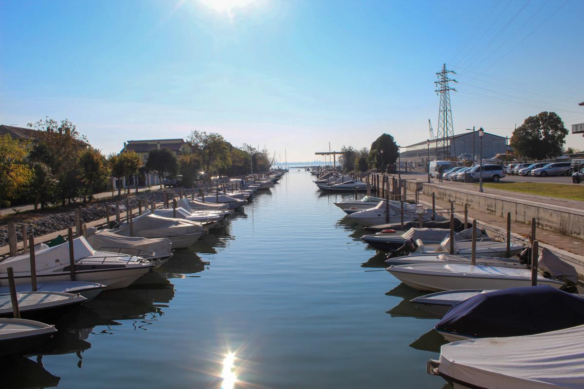
Forte Marghera offers a large free car park for those arriving by car, and is convenient for those arriving by public transport. In front of the entrance to the fort, there is a bicycle hire station operated by the MoVeNice rental service, where you can rent a push-bike or even an e-bike. Cyclists are invited to observe the vertical and horizontal signs in order to follow the route and cycle paths.
Once in the saddle, cross the access bridge that leads to the inside of Forte Marghera, turn left and continue in a loop that will lead you to Forte Marghera bay.
Forte Marghera is the most important, oldest and largest fort in Mestre, built at the closest point between the mainland and Venice. The fort occupies the spot once covered by the old village of Marghera. Evidence of this is provided by the building on the left, at the entrance to the fort, which is characterised by three arches. It used to be a bridge back in the sixteenth century and was later transformed into a building and incorporated into the construction of the fortification, begun in 1805 by the Austrian troops and supplemented with other structures by the Napoleonic troops until 1814, when the area was definitively returned to Austrian rule.
In the twentieth century, with the onset of the First World War, the fort became a logistics hub for the north-east and was supplemented with additional buildings that define its current layout. It has been owned by the City of Venice since 2010 and has been home to the Fondazione Forte Marghera since 2015, established in order to manage the fort and to study and promote its cultural heritage.
The former military structure currently houses numerous refreshment points, military buildings, the Museo Storico Militare (Military History Museum) and the specialist library dedicated to the study of military fortifications. It also hosts exhibitions organised by the Musei Civici (Civic Museums) and the Biennale Arte. The fort is completely immersed in the local nature, amidst the remains of shipwrecks, military structures and numerous local creatures, such as the cats and birds that live there.
In summer, the bay becomes a meeting point for events and aperitifs with views over the canal leading to Venice.
Useful information:
Forte Marghera: free entry, closed on Mondays.
Transport: Forte Marghera Aretusa stop (bus nos. 9, 15, 43). Ample parking for cars. Bike hire nearby.
Official website: http://fondazionefortemarghera.it/
Museo Storico Militare: free entry http://fondazionefortemarghera.it/le-attivita/sono-presenti-al-forte/museo-storico-militare/
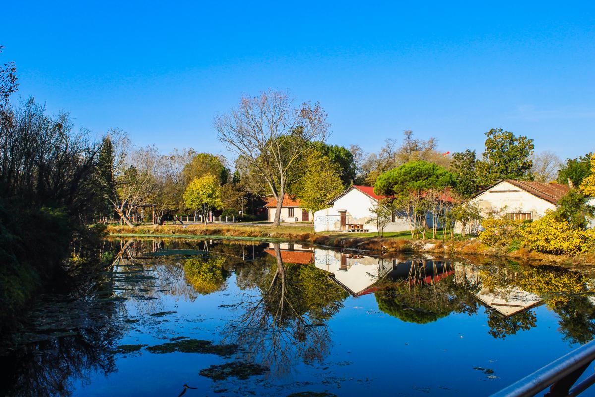
Forte Marghera, the most important and oldest military fort in Mestre
Stage 2: Bay of Forte Marghera – Parco San Giuliano
The cycle itinerary continues in the direction of Parco San Giuliano: leave the fort behind you and follow the yellow signs in the direction of Parco San Giuliano, then turn right and follow an asphalt road. Cross the road and take a short dirt track that links the fort to Viale San Marco. Here, near the pedestrian crossing, you will find yellow signs with directions to the park and, on the other side of the road, a MoVeNice bicycle parking area. Cross the road and continue to the right, climbing onto the cable-stayed bridge that connects Viale San Marco to Parco San Giuliano, the green lung of the lagoon city.
Parco San Giuliano is Italy’s second largest urban park, inaugurated in 2004. Spanning 74 hectares, it is the largest park in Venice, frequented by residents for outdoor sports: the park contains basketball courts, a skating rink and areas equipped for individual exercises, as well as a children’s play area. Its extensive lawns are also the perfect place to relax in green surroundings and are often used to host major events such as concerts. The park also offers food and drink areas, drinking water fountains and public toilets.
Useful information:
- Parco San Giuliano: https://www.comune.venezia.it/it/content/parco-san-giuliano
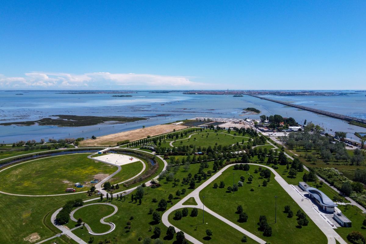
Parco San Giuliano with the Ponte della Libertà and Venice in the background
Stage 3: Parco San Giuliano – Punta San Giuliano
Once you have crossed the cable-stayed bridge, you will find yourself at Porta Rossa, a building that houses a bar with outdoor tables, toilets and the municipal office for the management of the park. We advise you to make your way through the park along the route of your choice, discovering different views across the lagoon, either from the hill, stretching to the edge of the lagoon, or Punta San Giuliano. This area of the park looks onto the lagoon directly and offers a wonderful view of Venice, so we recommend a short stop at this viewpoint to admire the animals and plants of the lagoon ecosystem.
In the 1930s, Punta San Giuliano was the only beach in Mestre, home to a heliotherapy colony whose buildings are currently used by sports and rowing clubs, such as the Società Canottieri Mestre ADS, where kayaking, canoeing and dragon boat rowing lessons are held. “Voga alla Veneta” (Venetian-style rowing) is also practised here. This traditional rowing technique is typical of the lagoon and strongly reflects the Venetian identity. The Gruppo Sportivo Voga Veneta Mestre, a cultural sports association, operates with the aim of spreading “Voga alla Veneta” and its traditions, as well as preserving the Venetian lagoon’s typical boats.
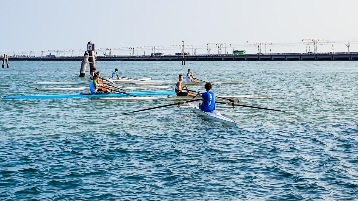
Punta San Giuliano is popular for all sorts of water sports
Stage 4: Punta San Giuliano - Passo Campalto
It’s now time to head towards Passo Campalto. From Punta San Giuliano, go back towards Porta Rossa. Pass the playground area on the left, and you will find a small road on the right that marks the beginning of the nature and cycle path. Continue along the asphalt road until you reach an iron bridge that separates the lagoon from the Osellino canal.
Push your bicycle across the bridge and continue along the dirt track that leads to Passo Campalto: on one side you will skirt the Osellino canal, while lush vegetation grows on the other side. The end of the Parco San Giuliano – Passo Campalto stretch looks onto the lagoon’s characteristic salt marshes. Venice and its lagoon are a UNESCO World Heritage Site, and their uniqueness comes from their interconnection: the salt marshes are an authentic part of the lagoon’s heritage and are essential to preserving its integrity. The salt marshes consist of land that emerges due to the effect of low tide at certain times of the year. The salt marsh environment is unique, characterised by halophilous vegetation capable of adapting to highly saline and often waterlogged soils. It is an ideal habitat for many species of birds and for a rare ecosystem of plants such as Salicornia and Limonium.
Some of you might be interested to see the small wooden boat stuck in the sand at the end of the route, which has become the symbol of the route itself and has a quote by Leopardi painted on it: “Shipwreck seems sweet to me in this sea”.
The dirt road stops briefly near the small, traditional canal-port of Campalto, called “Passo Campalto”, which frames a sweeping view of Venice and its lagoon. It was once one of the lagoon’s landing places for exchanging goods and over time has become a popular boating spot. From here you can admire the Venice skyline and spot the bell tower of San Marco.
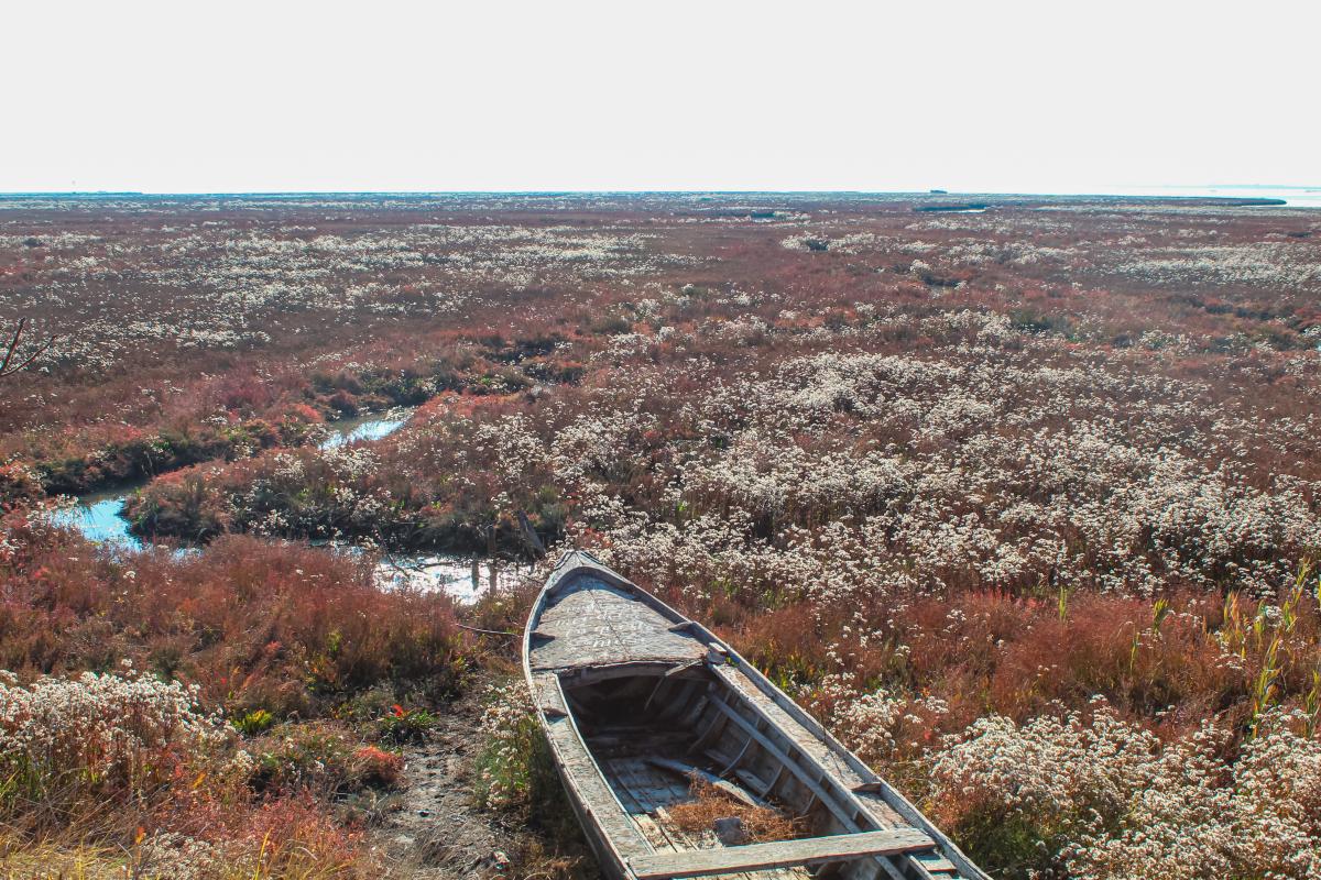
The stranded boat that has become the symbol of the Passo Campalto salt marsh itinerary
Stage 5: Campalto Pass - Campalto salt marshes
From Passo Campalto, the route resumes and joins the clearly visible and well signposted dirt track. The route called “Passeggiata delle Barene di Campalto” (Campalto salt marsh walk) looks onto the splendid salt marshes which take on different shapes and hues according to the time of year and the tide levels.
It is well worth bringing binoculars here to observe the local wildlife: cormorants, swans, herons, egrets, sacred ibises and sometimes flamingos (only when there is a particularly low tide that allows them to find food here). Visible to the naked eye are the outlines of the main islands, including Torcello, Burano and Mazzorbo, with the view stretching as far south as the Ponte della Libertà. There are benches along the dirt track where you can stop for a break or to do a bit of birdwatching. Local residents often visit these lagoon areas for wild herbs to make dishes with bruscandoli (wild hops) and carletti, so don't be surprised you see people intent on picking them here in the spring.
A dock at Passo Campalto
Stage 6: Campalto sal marshes - Forte Bazzera
To continue the itinerary, cross the wooden bridge and continue along the embankment that runs alongside the canal, following the brown signs that say “pista ciclopedonabile per Forte Bazzera” (cycle/pedestrian path to Forte Bazzera). This stretch up to the fort once again runs through green countryside and is characterised by two water pumps, one at Campalto and the other at Tessera.
Continue straight ahead until you come to Forte Bazzera, located in Tessera, near Marco Polo airport. Originally founded as Polveriera Bazzera (a gunpowder magazine) in 1910, the structure was used as a munitions and explosives depot to serve the other forts in the city. It was later renamed as a fort. The fort is currently accessible by crossing a wooden bridge and is completely surrounded by the waters of the Bazzera drain. Since its restoration in the 1990s, the fort has become a little oasis of peace where events of various kinds are sometimes organised. We recommend paying a visit to this small fort, leaving your bicycles in the racks at the entrance.
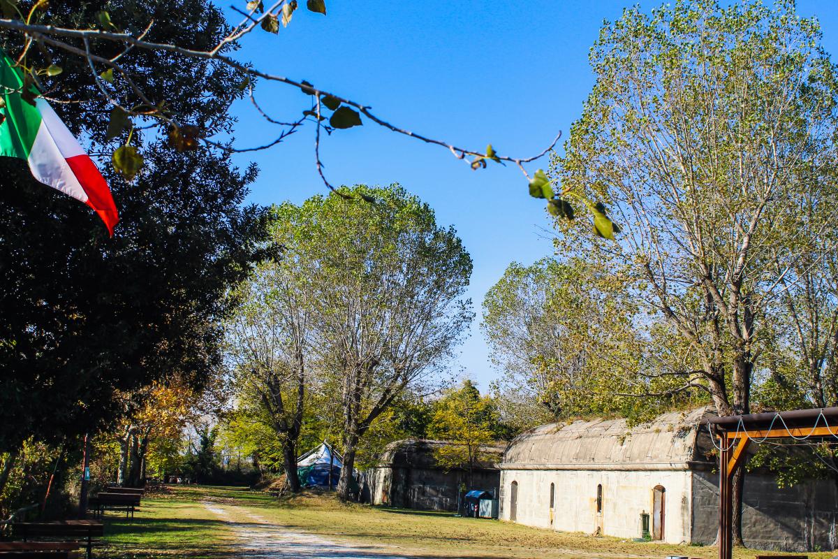
Forte Bazzera
Stage 7: Forte Bazzera - Punta Bazzera
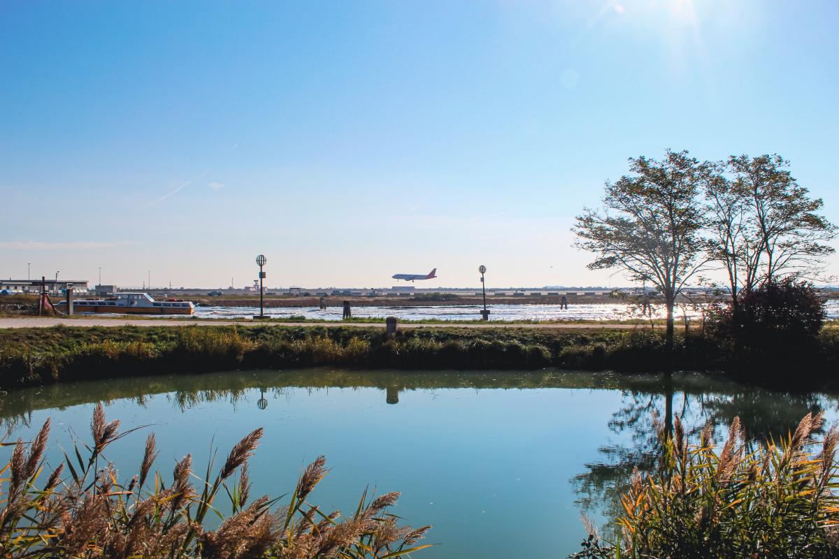
To reach the last stage of the itinerary, head towards the gate that marks the entrance to the fort area and follow a short asphalted stretch. At the first bridge, turn right and pass the barrier that marks the start of the route to Punta Bazzera. This area is very close to Marco Polo airport in Tessera, and you can watch the aeroplanes taking off and landing from here.
Go straight on along the cycle/pedestrian track to Punta Lunga, an area perfect for barbecues and parties. Follow the various dirt tracks that join up and lead to Punta Bazzera: the area closest to the lagoon, surrounded by salt marshes and lagoon vegetation. From this point you will have a clear view of the aeroplanes, the lagoon and the canals connecting Venice and the airport. As you will notice from the clayey ground under your feet, this area is often inaccessible during periods of high tide.
Returning to the tree-lined cycle/pedestrian path, take a rest to admire the lagoon before setting off on your way back.
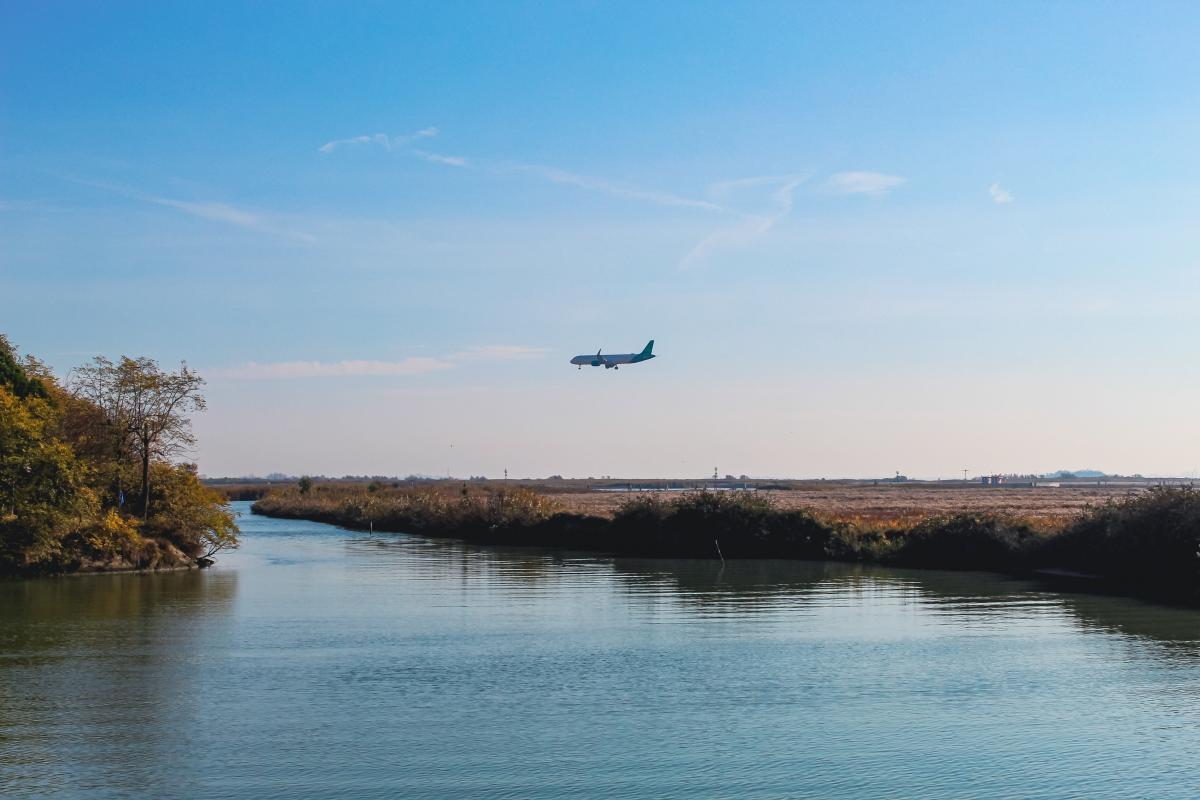
Aeroplanes at Marco Polo airport are clearly visible from Punta Bazzera
Arrival: Punta Bazzera - Forte Marghera
From Punta Bazzera, the route back to Forte Marghera begins by following the brown signs with the words “pista ciclopedonale per Passo Campalto” (cycle/pedestrian path to Passo Campalto).
Return to Forte Bazzera, follow the cycle/pedestrian path as far as the Tessera pumping station, keep to the left and continue along the embankment that runs alongside the canal as far as the wooden bridge. On the way back, we advise you to admire the orderly crop fields of the countryside on the mainland. Near the wooden bridge are the Campalto woods, created in 2007. This is an example of natural woodland used as an urban park, where you can relax and have a rest. To get to the woods, follow a dirt track just before you cross the wooden bridge, go straight ahead and then follow the track that loops around the woods.
Continue by crossing the bridge and following the itinerary in reverse, passing by the Campalto salt marshes in the hope of seeing a splendid sunset over the lagoon and taking some stunning shots (if you do the route in the afternoon). Once you reach Parco San Giuliano, you can decide whether to return to the starting point, i.e. Forte Marghera, or stop at Parco San Giuliano, which also has good public transport links and plenty of parking facilities.
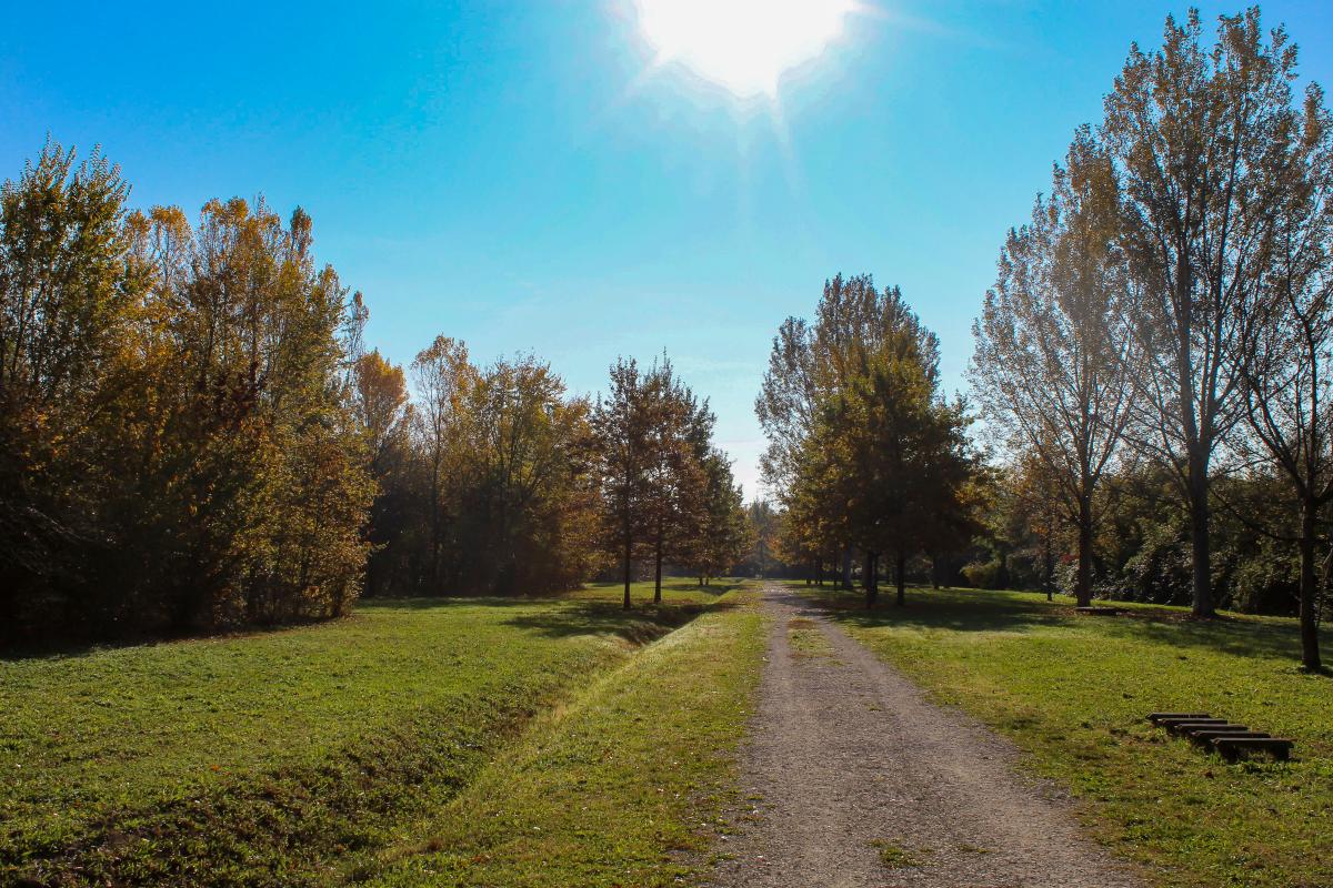
Campalto woods
-
Pierluigi Rizzato. 2017. Storia di Mestre – dalle origini ai giorni nostri. Edizioni Biblioteca dell’immagine
-
Guida Rossa Touring Club Italiano. 2005. Venezia. La biblioteca di Repubblica